Aerial Photography Services
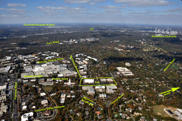
Oblique Aerial photography
Pictures taken of your site at an angle – just like you would see them out the window of an airplane. This viewpoint shows the relationship of your site with the surrounding properties and access roads.
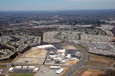
Vertical Aerial photography
Pictures from directly overhead. While we do not provide calibrated photogrammetry, this viewpoint taken with the same digital camera used for our oblique aerial photography shows an accurate picture of the layout and features of your site.
Aerial Photograph Labeling
Roads, buildings, points of interest can all be labeled. These are done in Photoshop and the file with layers will be provided to you so you can select which labels to display or print.
Prints, displays, and other Photographic Media
Most of our clients prefer to arrange for their own prints using our digital images. This is fine since you own all reprint rights to your images. However, we can provide prints and other media from postcards to wall displays.
Construction Progress Photography
Aerial photographs are taken at regular intervals that you specify in order to show progress of construction at your site. A pricing discount is provided for these multiple photo shoots.
704 519 6746